[ad_1]
Go World Travel is reader-supported and may earn a commission from purchases made through links in this piece.
Standing at the edge of Ireland’s highest cliff known as Fairhead, a dragon suddenly shot into my mind and vanished on the horizon.
The raw saline air rising from the sea of Moyle, facing the cliff, can easily twist the imagination. While the fatigue of hiking through the steep path can slow down thinking. Hence, making the fantasies appear alive and vivid.
Fairhead Cliff was filmed as Dragonstone in the famous Game of Thrones TV series. In season seven, Daenerys, the protagonist, stirred her dragon into the air from its cliff edge.
Despite its recognition from the show, Fairhead remains the least visited destination for lying in the remotest northeast corner of Northern Ireland. Nevertheless, its peculiar 660 feet cliff attracts professional climbers from around the world.
With a sprawling five-kilometer ridge, Fairhead harbors lonesome hiking routes, the rarest wilderness, ancient lakes, and eerie tales.
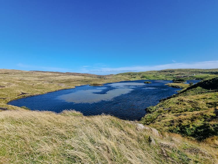 Lake visible from the Fairhead trail. Photo by Eva Badola
Mysterious Island Lake
The Fairhead trail began as a narrow pathway, but gradually expanded into a vast, undulating shrubby grassland dotted with a deep lake, Lough na Cranagh. Remarkably, this lake originated 17,000 years ago during the Ice Age. As the glacier’s base eroded, it left behind hollows that got filled with melted ice, giving birth to Lake Cranagh.
But within the lake stood a strange island shrouded in several mysteries. Despite being cloaked in greenery, the island’s features suggested a human intervention. A 1.5-meter-high drystone wall was artfully constructed atop a broad oval bank made from boulders. Brown trout swarmed in the lake, making the island a perfect fishing spot. But soon, it turned out that the island offered way more than fishing.
The path ascended over a moorland where sheep were grazing on a family farm. A farmer there explained that the islands are called crannogs. The crannogs were constructed by farmers during the Iron Age. In case of an attack by raiders, they used them as shelters alongside their cattle. Among the 2,000 Crannogs in Ireland, Lake Cranagh’s island is the most well-preserved one.
Local legends say that large crannogs had secret underground escape tunnels. The ancient people would engrave tunnel walls with ‘Ogham’, the early-medieval Irish alphabet. It was believed that the alphabet mystically protected the tunnels from collapsing.
In fact, not only the mysterious crannogs but the entire natural world in Irish culture is narrated through myths and legends.
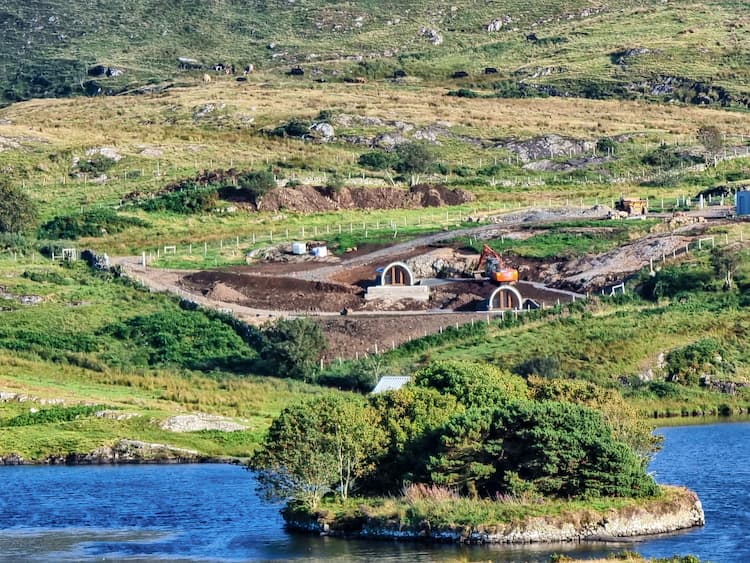 Trees and bush-covered Crannog. Photo by Eva Badola
If Legends Come True…
The trail extended beyond the farmland until it eventually arrived at the renowned cliff. The nesting Peregrine falcons were soaring overhead while the sea waves were rattling below. Despite a clear view of Rathlin Island and Scotland from the cliff, the stormy wind lashed at its edge, making it difficult to balance at its border.
The hostile setting triggered the memory of a bizarre story I had heard from a taxi driver named Billy on the way to Fairhead. Known as ‘Children of Lir’, the fable is about an evil spell that turned three children into swans. They continued floating for 300 years over the turbulent sea below the cliff until the spell was broken.
Pain, sorrow, and longings are visible in numerous ancient Irish tales, and they resonate deeper when visiting a land with no human trace. However, in this solitude wilderness, you also feel calmer and more attuned to nature.
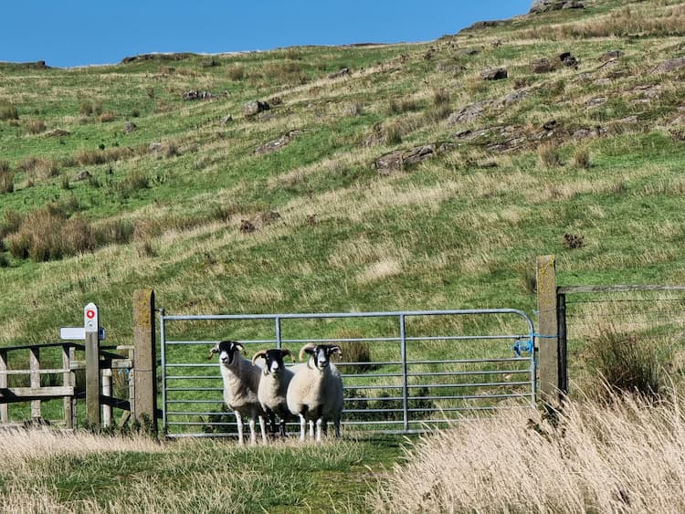 Entrance to the private farmland. Photo by Eva Badola
The Rare Heathland
Fairhead expresses a dramatic climate. Walking along the cliff’s narrow ridge, clouds began hovering in the sunny sky and it started drizzling.
A blunt shortcut through slippery slopes and muddy spots gradually descended into a deep gully created by the rain. It ultimately opened into a vast clear land revealing another beautiful Lake ‘Lough Dubh’. However, the area owned something more distinctive.
The entire rocky terrain was carpeted with clusters of pink Bell heather flowers while yellow lichens scrambled between them like modern art.
It was one of the rarest habitats known as ‘Heathland’. Heathlands are wide open landscapes with dwarf woody shrubs and grasses. They may seem ordinary but are actually rarer than rainforests with only 15 percent of these remaining in the UK. While most heathlands have been destroyed due to chaotic development, Fairhead’s heathland is still intact and undamaged, thanks to its remoteness.
Heathlands have an intriguing history. Around 5000 years ago, humans cleared forests for hunting and later burnt them for cropping. Consequently, the soil became acidic and infertile. Surprisingly, this altered condition highly suited and attracted heathland plants.
Not only lichens, mosses, and fungi but rare plants and animals made heathlands their home. Heaths became part of Irish farming culture, being used for fuel, livestock grazing, and bedding for cattle.
However, it is not only the heathland but also Fairhead’s unique rocks that make it an ‘Area of Special Scientific Interest’.
 Heathland with sheep and lake. Photo by Eva Badola
A Climber’s Paradise
It was extremely scary to spot abandoned climbing gears strewn atop the ‘Rathlin Wall’, a steep rock face on the Fairhead Cliff.
As the rain halted, I advanced towards an elevated point where the Rathlin wall was clearly visible. Remarkably, Rathlin stands as the biggest climbable rock in both Ireland and Britain. But its structure is so peculiar that only seasoned climbers with unfamiliar skills can scale it. Demanding utmost caution, the cliff is highly prone to mishaps.
Fortunately, the gears were not abandoned; instead, belonged to a climber who was sliding down the cliff. With ropes and a friction device, she carefully footed on the snaky columns that make the cliff’s upper part. In stark contrast, the cliff’s lower part was highly chalky. She gingerly descended this brittle white-rocky base, landing among the rare yellow Saxifraga flowers.
Undoubtedly, the climb was not for the faint-hearted. Particularly due to the unusual formations which are the result of a violent past event.
The cliff’s face is embossed with vertical layers of rocks, forming giant columns. These columns were formed due to a violent volcano that exploded 60 million years ago. During the explosions, the lava rocks got injected between the layers of older sedimentary rocks. This resulted in long parallel columns that looked like organ pipes.
The volcanic fire not only shaped Fairhead’s geology but also influenced its human history. Like pottery in a kiln, the volcanic heat baked the rocks into Porcellanite which was harder and sharper at the edges. Early humans from the Stone Age knapped these porcellanites into stone tools and axes.
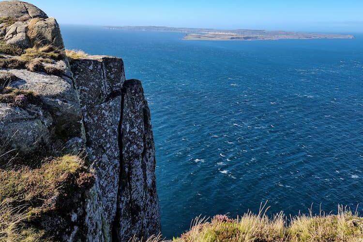 The sea facing Cliff. Photo by Eva Badola
On completing the 4.2 miles trail, it felt satisfying to witness the place in person rather than through a screen. I recounted a fantasy novel called ‘A Song of Ice and Fire’ that inspired Games of Thrones. The title aptly reflects Fairhead’s formation journey, sculpted by combined forces of ice and fire.
If You Go
Getting There
From Belfast, the capital of Northern Ireland, it takes one hour and 20 minutes to reach Fairhead. The easiest and cheapest way is to rent a car from Belfast Europa Bus Station and drive towards the Causeway Coast in the north. Simply follow the signs directed toward Ballycastle.
From Ballycastle, follow brown signs to reach Fairhead’s Car Park in 10 to 15 minutes.
Where to Stay
Make Ballycastle your base to explore Fairhead and nearby destinations. The town has several Airbnb options.
What to Know
Fairhead has a car park facility but no cafe or shop, so pack your supplies in Ballycastle. Wear walking boots as the surface is often uneven or wet. Also, the clifftop has no safety railings, so keep a distance from the edge.
Best Hiking Trails
Take a photo of the maps and information on the trailhead panel in the car park. It has five route choices: a 1.5-mile circular walk (red loop), 2.2-mile (purple route), 3.1-mile (green route), 3.3 miles (blue route), and the most strenuous 2.9-mile walk (yellow route).
From the yellow route, you can also retrace your steps to rejoin the blue route, covering a total of 4.2 miles.
Other Things to Do
Indulge in refreshing breakfast at Our Dollys Café before relaxing on the sandy Ballycastle beach. Next day, head to the isolated Rathlin Island which refuges thousands of seabirds, seal colonies, and rare sightings of killer and minke whales. A car and passenger ferry runs from Ballycastle, taking 30 and 40 minutes to reach the isolated island.
Another overlooked destination is Murlough, Harboring a Bay and Nature Reserve. Enjoy the Bay, which is backed by green sloping hills and curved limestone cliffs. Murlough safeguards the few remaining ‘natural temperate’ woodlands in Ireland. Alternatively, explore the intrinsic trails through the sandy dunes in the Murlough National Nature Reserve.
Other Info
Rock climbing:
Dal Riada Climbing Club (@dal_riada_climbing_club) • Instagram photos and videos
Historical:
Glens Of Antrim Historical Society – Formed in 1965 & recognised as one of the foremost Historical Societies in Ireland (antrimhistory.net)
Inspire your next adventure with our articles below:
Author Bio: Eva Badola is a UK-based Indian writer and explorer who focuses on nature, culture, and sustainability. As the leading author, her book, ‘Stories of Success: Narratives from a Sacred Land’ covers stories along the remote Indo-Nepal border.
[ad_2]
Source link
Jarastyle – #Exploring #Northern #Irelands #Enigmatic #Fairhead
Courtesy : https://www.goworldtravel.com/exploring-northern-irelands-enigmatic-fairhead/?utm_source=rss&utm_medium=rss&utm_campaign=exploring-northern-irelands-enigmatic-fairhead

